Animals exploit numerous sources of information while migrating, homing, or moving around their habitats. Among these, the Earth’s magnetic field is a particularly pervasive environmental feature. In contrast with most other cues, the field is present both day and night, is largely unaffected by weather and season, and exists virtually everywhere on the planet, from the deepest ocean trenches to the highest elevations that a bird can fly. Thus, it is perhaps not surprising that diverse organisms, ranging from bacteria to vertebrate animals, have evolved ways to exploit the geomagnetic field to guide their movements.
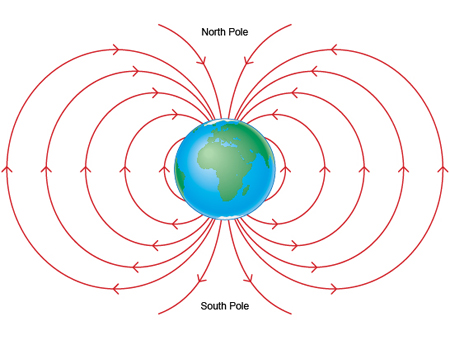
Diagram of Earth’s magnetic field.
The Earth’s field provides animals with two potential types of information. The simplest of these is directional or compass information, which enables an animal to maintain a consistent heading in a particular direction such as north or south. Magnetic compasses are phylogenetically widespread and exist in several invertebrate groups, as well as in all major groups of vertebrate animals.
Alone, a compass is often insufficient to guide an animal to a specific destination or to steer it reliably along a long and complex migratory route. For example, a sea turtle migrating through the ocean toward a distant target can be swept off course by currents, and a migratory bird’s heading can be altered by wind. Navigation can therefore be enhanced by an ability to determine geographic position. For human navigators, this need is now usually met by a global positioning system (GPS), which can provide geographic position and, when necessary, compute the direction to a specific goal. For some migratory animals, positional information inherent in the Earth’s magnetic field provides a similar, although considerably less precise, way of assessing geographic location. Animals that can derive positional information from the Earth’s field (as opposed to directional information) are often said to have a “magnetic map”.
It is important to recognize that the term “map”, although ingrained in the animal navigation literature, is imprecise and perhaps unfortunate, inasmuch as it connotes specific spatial representations used by humans. In reality, little is known about whether internal spatial representations exist in animals and, if they do, how closely they conform to human concepts of maps. Increasingly, however, “map” has come to be used in a broad and almost metaphorical sense. As used in the animal navigation literature, the term “magnetic map” is now a convenient shorthand that encompasses all uses of positional information in the Earth’s field and makes no assumptions about the nature of the internal spatial representation (if any) that a particular animal has. Thus, the information in a magnetic map may be inherited or learned, specific or general, and used for diverse purposes depending on the needs of the animal. A magnetic map might, for example, tell an animal that it has arrived at a point in a migratory route where it should orient westward or that it is approximately north or south of the area where it lives. In sum, animal has a magnetic map if it uses the Earth’s magnetic field as a source of positional information, whereas it has a magnetic compass if it uses the field as a source of directional information. Some animals, of course, have both.
The principles of magnetic maps first discovered in sea turtles and lobsters have been shown to also exist in other diverse animals that migrate long distances, including salmon, eels, and birds.
References
Lohmann, K. J., Lohmann, C. M. F., and N. F. Putman. 2007. Magnetic maps in animals: Nature’s GPS. Journal of Experimental Biology 210: 3697-3705. [Download pdf]
Lohmann, K. J., Lohmann, C. M. F., Ehrhart, L. M., Bagley, D. A., and T. Swing. 2004. Geomagnetic map used in sea turtle navigation. Nature. 428: 909-910. [Download pdf] [Science]
Boles, L. C., and K. J. Lohmann. 2003. True navigation and magnetic maps in spiny lobsters. Nature. 421: 60-63. [Download pdf] [New York Times] [National Geographic] [Science News]
Lohmann, K. J., Cain, S. D., Dodge, S. A., and C. M. F. Lohmann. 2001. Regional magnetic fields as navigational markers for sea turtles. Science. 294: 364-366. [Download pdf] [Science Commentary] [BBC] [ABC News] [Science Daily] [National Geographic] [USA Today]
Lohmann, K. J., and C. M. F. Lohmann. 1996. Detection of magnetic field intensity by sea turtles. Nature. 380: 59-61. [Download pdf] [New York Times]
Lohmann, K. J., and C. M. F. Lohmann. 1994. Detection of magnetic inclination angle by sea turtles: a possible mechanism for determining latitude. Journal of Experimental Biology. 194: 23-32. [Download pdf]
Putman, N. F., Scanlan, M. M., Billman, E. J., O’Neil, J. P., Couture, R. B., Quinn, T. P., Lohmann, K. J., and D. L. G. Noakes. 2014. An inherited magnetic map guides ocean navigation in juvenile Pacific salmon. Current Biology. 24: 446-450.
Lohmann, K. J., Putman, N. F., and C. M. F. Lohmann. 2012. The magnetic map of hatchling loggerhead sea turtles. Current Opinion in Neurobiology. 22: 336-342. [Download pdf] [National Science Foundation] [Psychology Today] [RedOrbit]
Putman, N. F., Endres, C. S., Lohmann, C. M. F., and K. J. Lohmann. 2011. Longitude perception and bicoordinate magnetic maps in sea turtles. Current Biology. 21: 463-466. [Download pdf] [BBC] [National Geographic] [Science Daily] [NPR interview] [US News & World Report] [Discover]
Last updated 05.02.17